
Walker Property, Bozeman, Montana (1989 -1990)

Walker Property Master Plan illustrating the “cluster farm” concept with more than 60% open space that function as environmental area (floodplain) on the northeast edge and more central agriculture open space that can be used for grazing livestock.
MVH completed the Master Plan and Design Guidelines for this 52-hectare (128 acre) property on the edge of the City of Bozeman, Montana. The client followed the Master Plan and created a “farm cluster” community that followed its agricultural heritage. Over the years, the development has filled out complete with residential, office, childcare, and hotel components set against the spectacular Gallatin Mountain Range. The development is western in character, minimalist – low profile in design, and integrates clusters of buildings so that the Montana “Big Sky” landscape comes first. We got just that as you will see by the photographs of the elegantly executed development.

Zoning boundaries follow topographical features and floodplain not arbitrary legal boundaries

Design guidelines for residential development direct design, character, and placement of housing units (bottom) in a compact yet spacious footprint.
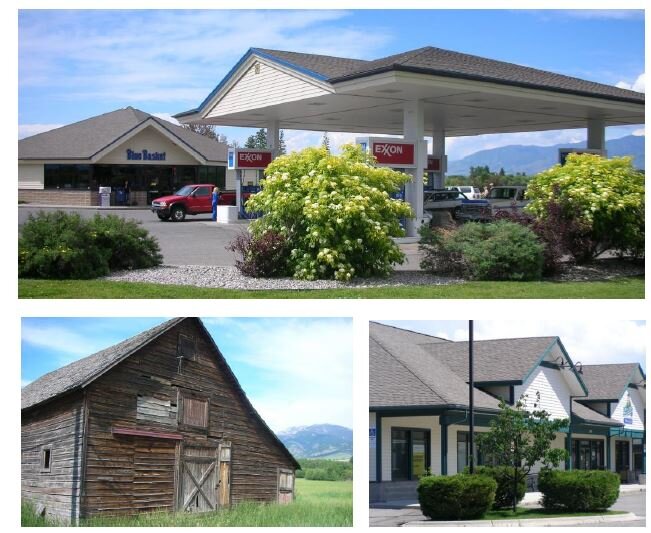
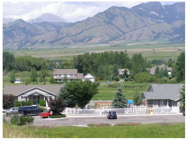
Built development following the farmstead character in materials, site planning, and building design. Open space, views and vistas, and low-profile building create the recipe that perfectly fits into the expansive and spectacular Montana landscape.